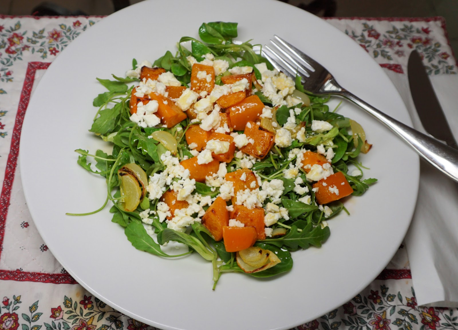
This recipe is inspired by a first course we had in a restaurant in Salo, Finland one snowy winter evening. The combination of roasted winter squash cubes, rocket salad leaves, and crumbled feta cheese was very tasty.
With some good wholegrain bread, you can serve the salad for a light and anti-oxidant rich lunch. A smaller portion makes a nice first course.
2 servings for lunch
2 handfuls of winter squash cubes
1 small onion, sliced
1 clove garlic, minced
Olive oil
3 handfuls of rocket salad leaves
A handful of crumbled feta
2 tbsp. olive oil vinaigrette
Preheat the oven to 210°C, roast.
Place 2 tbsp. olive oil in a plastic bag. Add the winter squash cubes, onion slices, and minced garlic. Shake well and pour into an oven- proof dish in one layer. Roast for 25- 30 minutes until the vegetables are soft and have got some colour. Set aside.
Divide the salad on the plates. Add the roasted vegetables and top with crumbled feta. Sprinkle with olive oil vinaigrette.
 |
| View southeast from Col des Estronques |
The 130 km* long GR58 (Tour de Queyras) long distance hiking trail connects St-Véran (2040 m) and Ceillac (1640 m) in the Queyras Regional Nature Park.
The trail runs via the Col des Estronques Mountain pass (2651 m). Some years ago, we had to turn around just before the col when a fierce thunderstorm hit the area.
 |
| Crossing Torrent de Curlet |
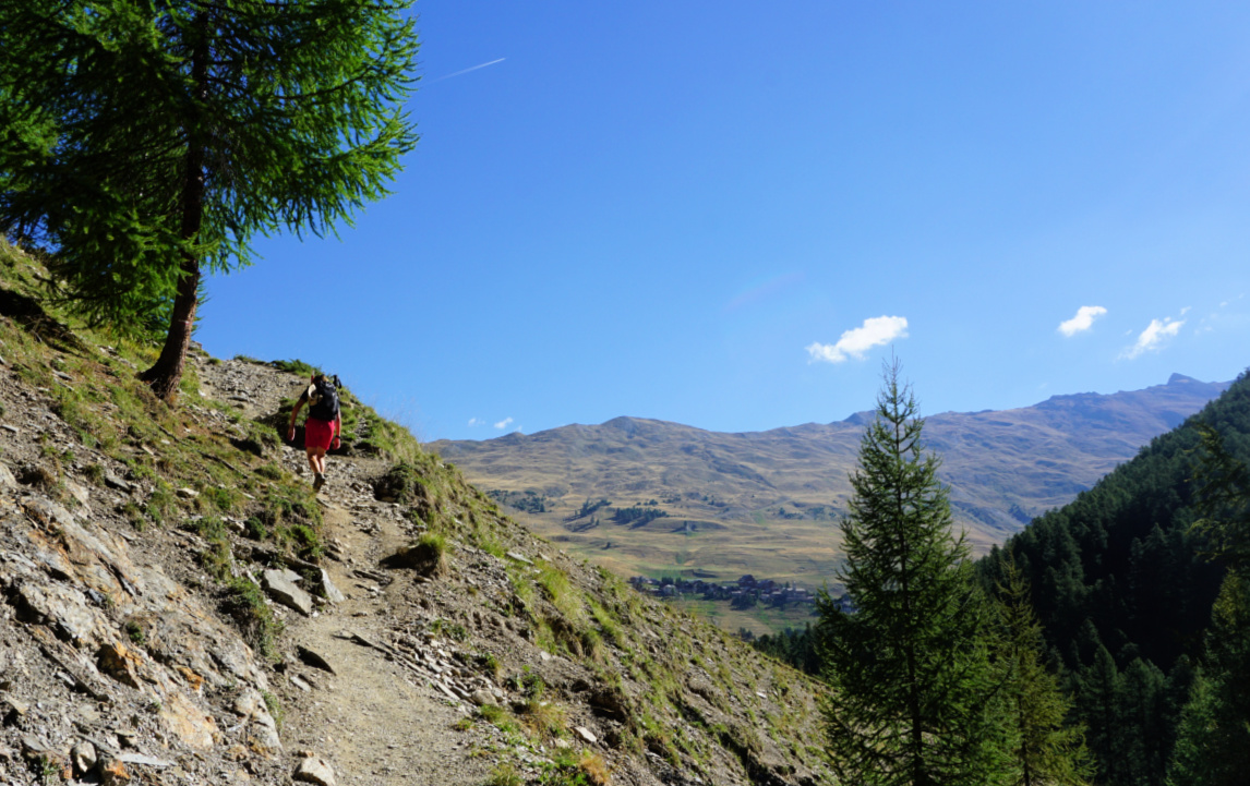 |
| GR58 after Torrent de Curlet |
 |
| GR58 Bois du Moulin in background |
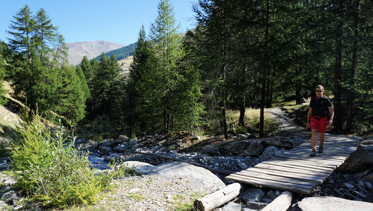
This time good weather was forecasted for the whole day, and we first descended along the GR58 from St-Véran to Pont du Moulin (1849 m), and crossed the l’Aguie Blanche torrent.
The continuous ascent started after the wooden bridge. We first followed a wide track, then a good path, and crossed the Torrent de Curlet. The incline became steeper. GR trails are very well marked (white-red) and this itinerary did not make an exception. We crossed another stream, and ascended a while in the woods before reaching beautiful Alpine meadow above the tree line. Our goal, Col des Estronques, was in sight. Some rocky stretches remained, nothing difficult or exposed. Apart from the rather short Alpine meadow, the trail was steep.
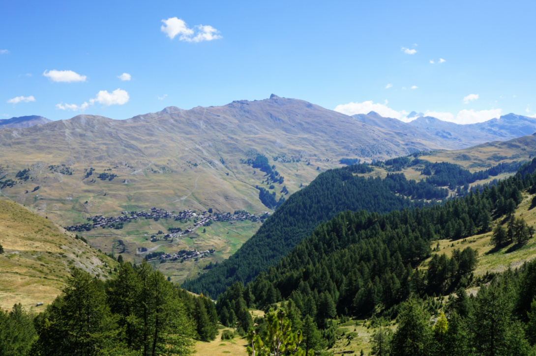 |
| Saint-Véran and Pic du Ch.Renard |
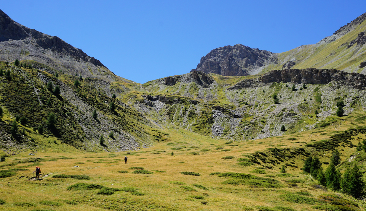 |
| Alpine meadow before Col des Estronques |
 |
| GR58 near col des Estronques |
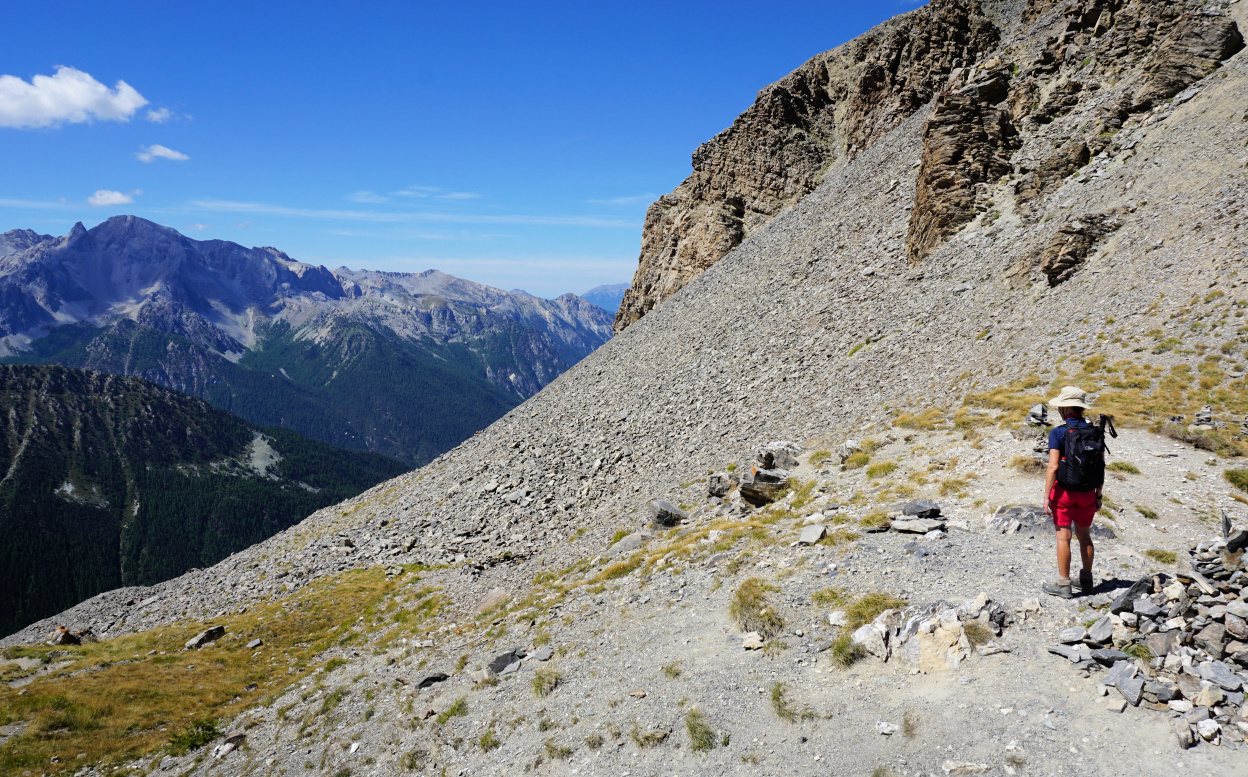 |
| Col des Estronques |
The day remained clear with just some cumulus clouds, and we could admire the mountain range south of Ceillac as well as the 3000+m peaks in the north, such as Grand Glaiza and Bric Froid.
A trail went up to Tête de Jacquette (2757 m), the nearest mountain top east of the col.
We took the same trail back to St-Véran. Depending on where you stay, the ascent from Pont du Moulin is 150-200 m.
Climb: ~950 m (ascent back to St-Véran included)
Duration: about 5 h active
Map: 3637 OT Mont Viso St-Véran. Aiguilles PNR du Queyras
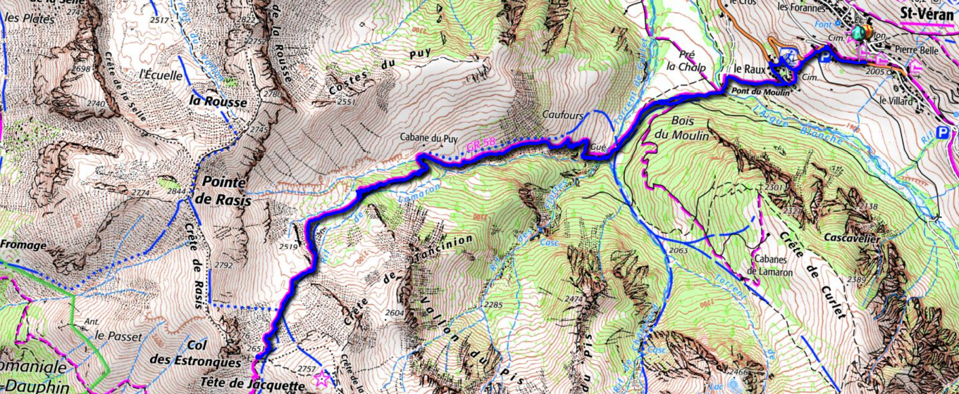 |
| Col des Estronques hike trail |
The following recipe makes a quick and tasty dinner when you need the food fast on the plates after a long day in the mountains or elsewhere…Serve it with black or parboiled brown rice and some simple roasted vegetables like courgette wedges or tomato halves.
2 servings
2 chicken breasts
2 tbsp. breadcrumbs
2 tbsp. grated parmesan cheese
Freshly ground black pepper
A generous amount, about 2 tbsp. Dijon mustard
Olive oil
Preheat the oven to 200° C, roast.
Combine the breadcrumbs, parmesan cheese, and black pepper. Spread the mixture on a plate.
Spread the mustard on both sides of chicken breasts, then coat them with the breadcrumb mixture. Transfer the chicken breasts in an oiled oven- proof dish and sprinkle some olive oil on them. Roast for 25 minutes together with the vegetables.
Meanwhile cook the rice. Divide the chicken, vegetables, and rice on the plates and decorate with some fresh herbs.
Pas de l'Ane above Monetier
In summer, some of the chairlifts in the Serre Chevalier area open, serving walkers, sightseers and mountain bikers.
Taking an advantage of them is a very good idea if thunderstorms are forecasted in the afternoon or if you simply prefer to do a shorter hike. But thanks to the vast network of trails, you can perfectly well start at over 2000 m elev. and still find long and strenuous itineraries if you wish.
Here’s what we did on the last two days of our stay:
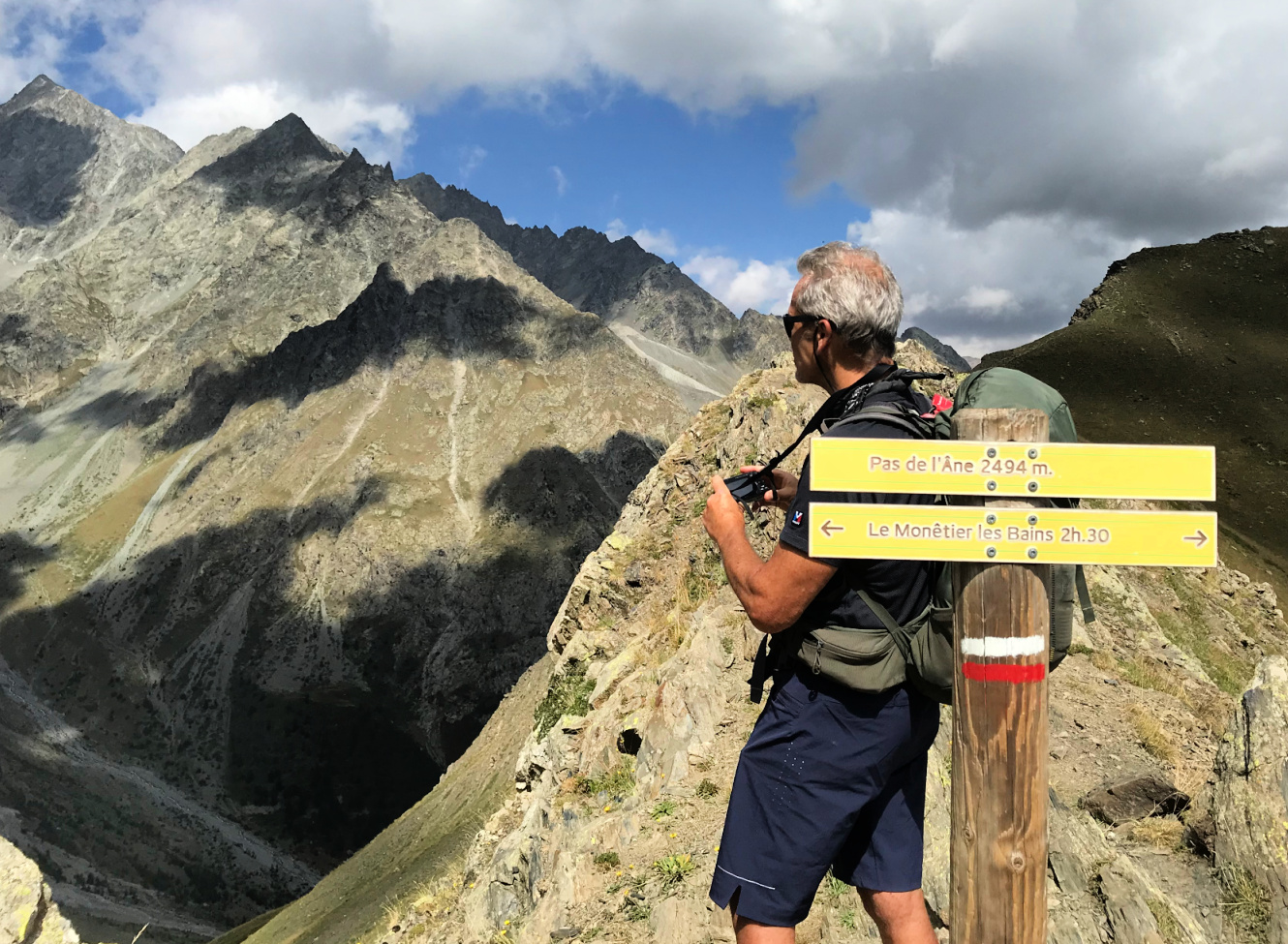
Day 1: Pas de l’Ane (2494 m)
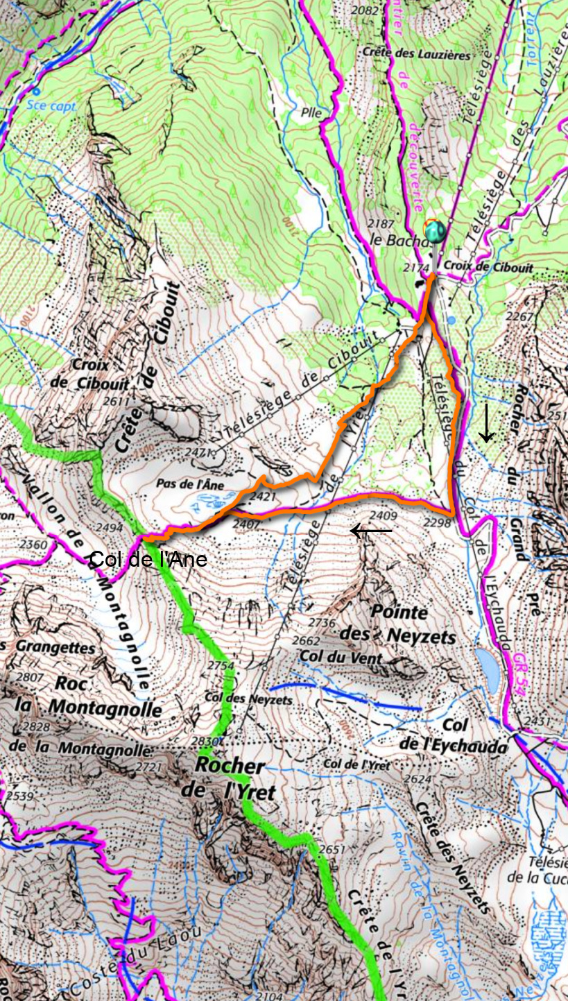
From Monétier les Bains (1500 m), we took the Bachas chair lift up to 2174 m. In winter, it is the westernmost part of the big Serre Chevalier ski resort. The GR54 runs past le Bachas.
We followed the GR54 to the south, ascending a bit. It was basically a wide track. After about one km, we forked right, first following another gravel track, then a path. The scenery was surprisingly wild and the incline became steep before the col. The mountain pass too was narrow and steep. The nearest glaciers were less than 3 km away in the west.
We descended back to the Bachas chairlift, first along the same trail, then took a shortcut along some unofficial trails and meadows.
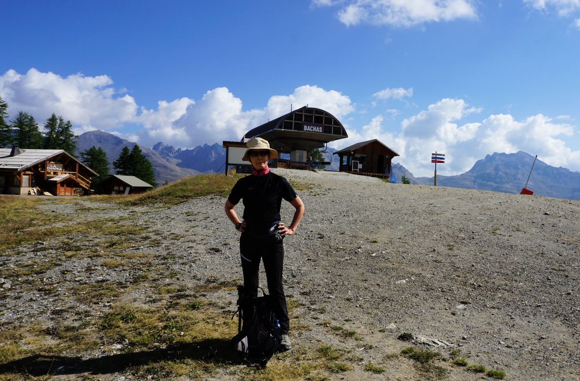 |
| Bachas chairlift Monêtier |
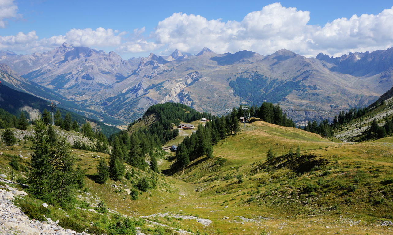 |
| Le Bachas view north |
 |
Towards Pas de l'Ane
|
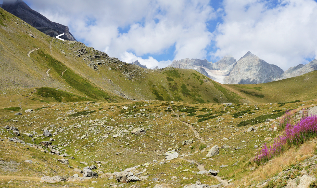 |
| Pas de l'Ane in sight |
 |
| Landscape west of Pas de l'Ane |
 |
| Monetier Pas de l'Ane hike track |
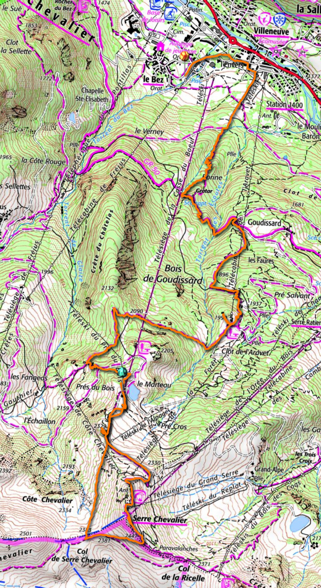
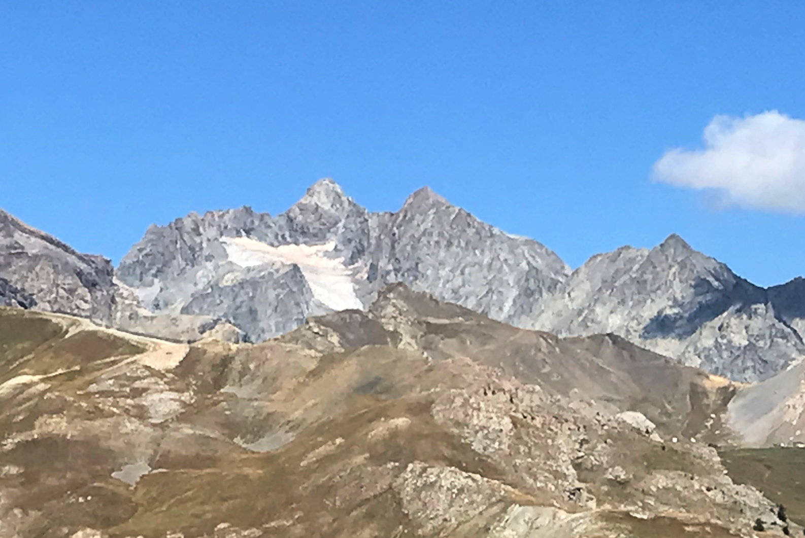
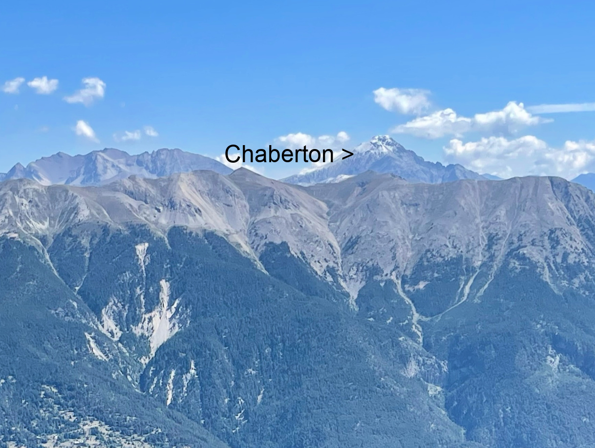
The long chairlift named Casse du Boeuf runs from the village of Villeneuve (1400 m) to about 2300 m. We paid 10,10€ p.p. for the ride (same as Bachas). We were in the middle of paths, tracks, ski lifts and of course mountain bike trails. The mountain peak of Serre Chevalier was still a bit above us in the south. We followed a trail which circled under its southern flank to Col de Serre Chevalier (2383 m), then forked left and climbed to the fairly crowded summit, where we could again admire the glaciers in the west and Mount Chaberton on the Italian border, still with fresh snow after the previous night’s storm.
We descended to the restaurant near our chair lift for lunch, then used the long and beautiful forest trail via Clot de l’Aravet and Goudissard (well signposted) back to Villeneuve.
 |
| View west from Serre Chevalier |
 |
| Glacier near Serre Chevalier |
 |
| Mount Chaberton viewed from Serre Chevalier |
Late one evening, we had a nice comforting pasta in an Italian Riverside restaurant in Savannah. We had been travelling all day and this warm and tasty dish was just what we needed. The pasta was grilled in individual oven- proof dishes until the cheese had melted and included a good mixture of vegetables: mushrooms, spinach, shallots, and garlic. It had quite a generous amount of cream sauce in the American style and the choice of two cheeses, parmesan and mozzarella, went well with the vegetables.
The following recipe is my twist of that pasta. I have omitted the cream and chosen wholewheat pasta for a healthier variation. Almost any pasta shapes work in this recipe except the long ones like spaghetti or tagliatelle.
If you have individual oven-proof dishes by all means use them for an impressive presentation. Our photo shows two portions of the recipe.
2 servings
2 handfuls of wholewheat pasta such as fusilli or penne
Olive oil
2 handfuls of sliced mushrooms
2- 3 shallots, chopped
1 clove garlic, minced
50 ml white wine
100 ml chicken stock
1 tsp. Provençal herbs
Freshly ground black pepper
3 handfuls of baby spinach leaves
1 small mozzarella ball
2 handfuls of grated parmesan
Warm 2 tbsp. olive oil in a sauté pan over medium heat. Fry the mushrooms until they start releasing some liquid. Add the shallots and garlic and continue sautéing for 5- 10 minutes stirring now and again. Add the white wine, chicken stock, herbs, and some black pepper. Reduce the heat for simmering.
Meanwhile cook the pasta, cut the mozzarella into eight chunks and grate the parmesan. When the pasta is cooked, drain it and add to the sauté pan. Add the spinach and continue sautéing until the spinach has just wilted.
Preheat the oven to 210°C, roast.
Transfer the pasta and vegetables into an oven- proof dish and fold in the parmesan. Scatter the mozzarella chunks among the pasta and vegetables. Roast for 5- 10 minutes until the mozzarella has melted.
 |
| Aguillette du Lauzet |
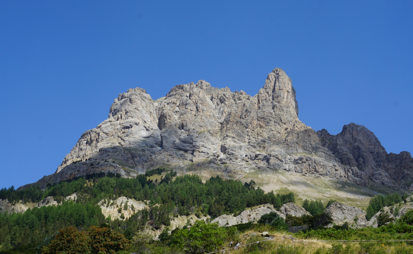
The following loop around the Aguillette du Lauzet Mountain (2717 m) is nicely described in Bernard Ranc’s great hiking guide Les plus belles randonnées des Alpes du Sud. The village of Le Lauzet is situated just some km northwest of Monêtier les Bains and less than 10 min by car.
For most hikers, the biggest attraction seemed to be Le Grand Lac (2282 m), north of Le Lauzet. The starting point, Le Pont de l’Alpe (1710 m), for both hikes is by the main D1091 road.
 |
| Ascent from Pont de l'Alpe GR50 |
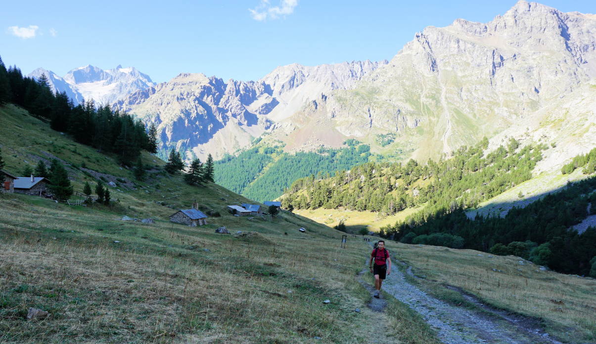 |
| L'Alpe du Lauzet |
 |
| Above l'Alpe du Lauzet |
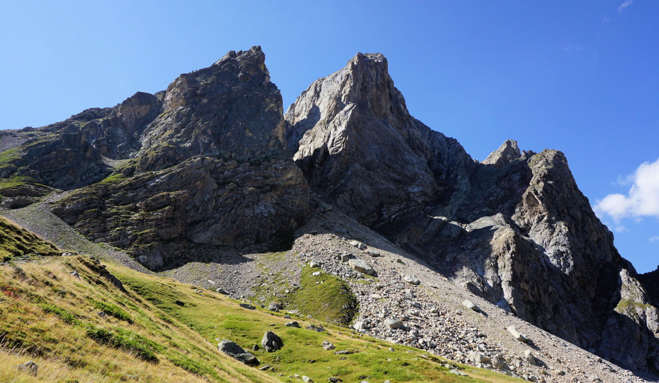 |
| Northern flank of Aguillette du Lauzet |
 |
| Leaving GR57for Col d'Aguilllette |
We started along the wide GR50 trail, having the steep western flank of the mountain to our right. At l’Alpe du Lauzet (1940 m), one trail forked left to the lake. We climbed northeast, towards Col du Chardonnet, following Torrent du Rif. There was a renown via ferrata to our right, and some climbers took advantage of that.
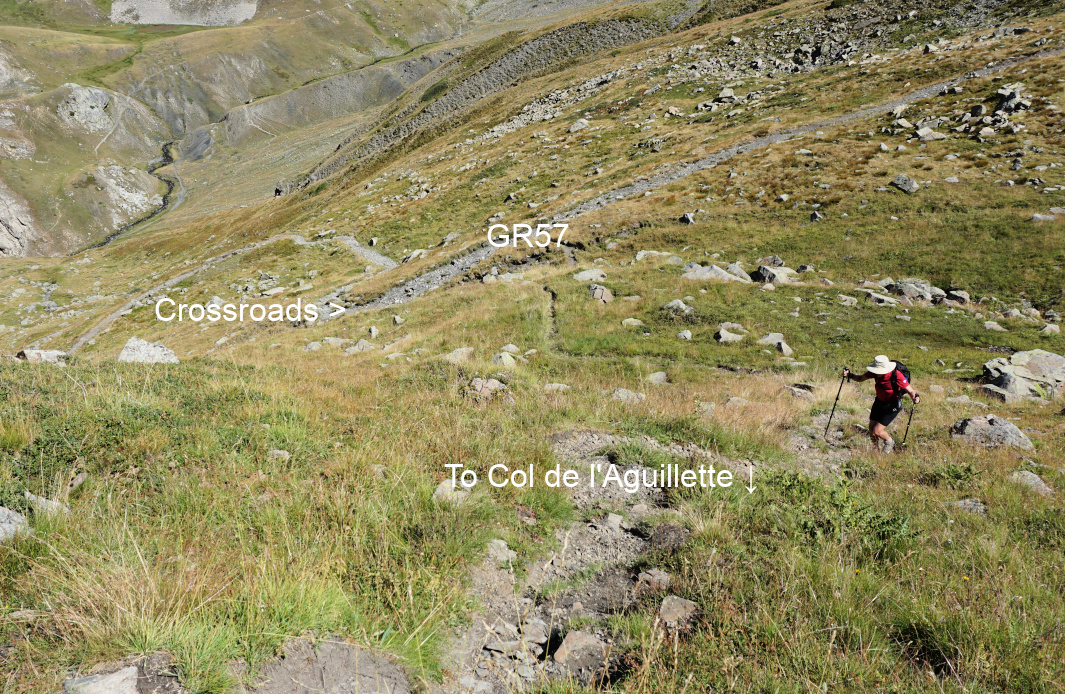
At the next crossroads (signpost), at about 2220 m, we reached the GR57 trail and forked right. We continued towards Col du Chardonnet. After several bends, we saw the unmarked trail at about 2400 m and forked right (image), leaving the GR57, and climbed to Col de l’Aguillette (2534 m). We continued almost horizontally along the eastern flank. Some parts of the trail were a bit exposed and the trail was narrow.
 |
| Col de l'Aguillette |
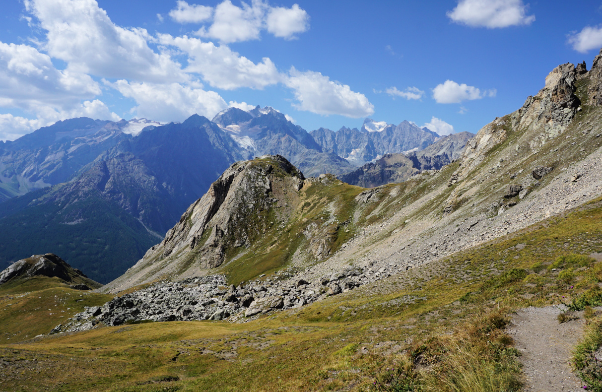 |
| Viewing Les Ecrins from Col de l'Aguillette |
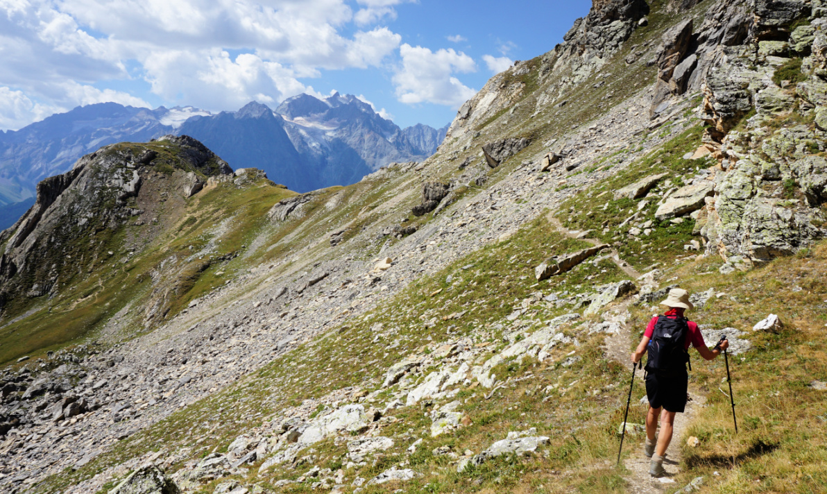 |
| Eastern flank of Aguillette du Lauzet |
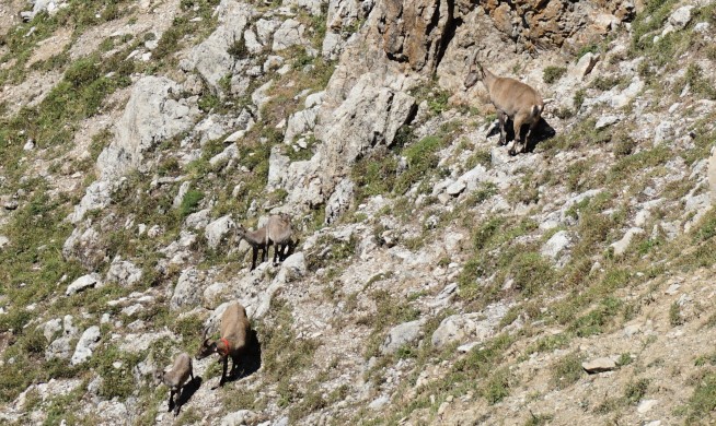 |
| Ibexes on Aguillette du Lauzet |
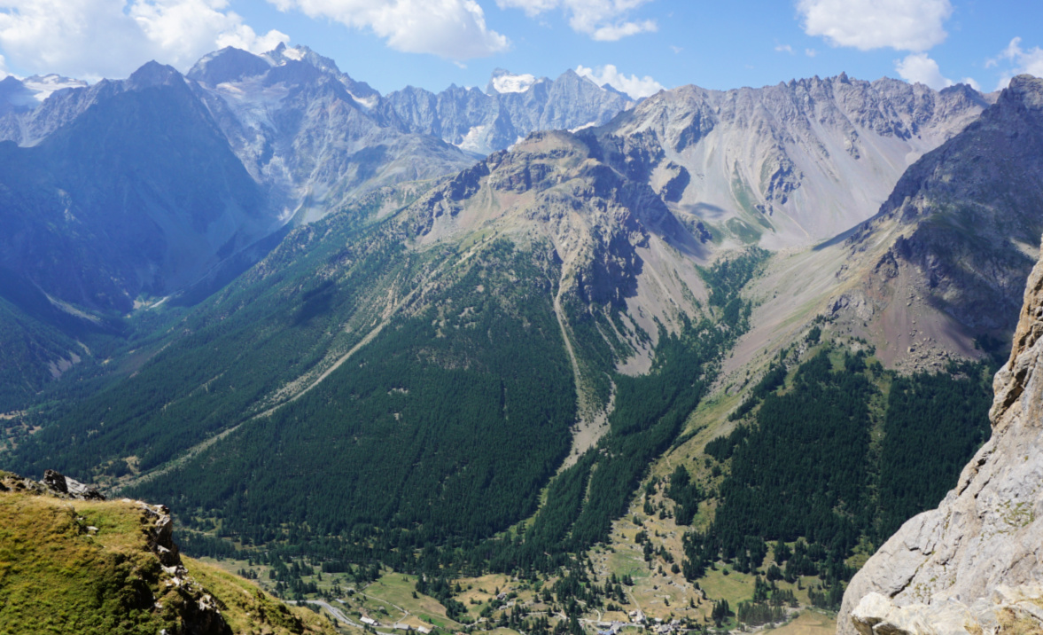 |
| View to La Guisane Valley |
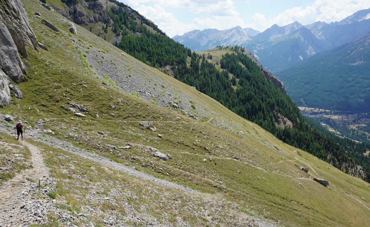 |
| Descending to GR50 |
 |
| Chemin du Roy GR50 |
We ignored the optional detour to the sub summit (2611 m). There were several ibexes on the nearby incline. We then followed the trail down to the valley and found a great spot for our picnic by the trail. We had super views south to the Ecrins Massif.
We descended along a path in the Rif Lanterne Valley until we reached GR50. We forked right and followed the comfortable path (Chemin du Roy), part of it in a magnificent forest, back to l’Alpe du Lauzet. We then descended back to our starting point.
Map: 3535 OT Névache Mont Thabor
 |
| Aguillette du Lauzet hike track |
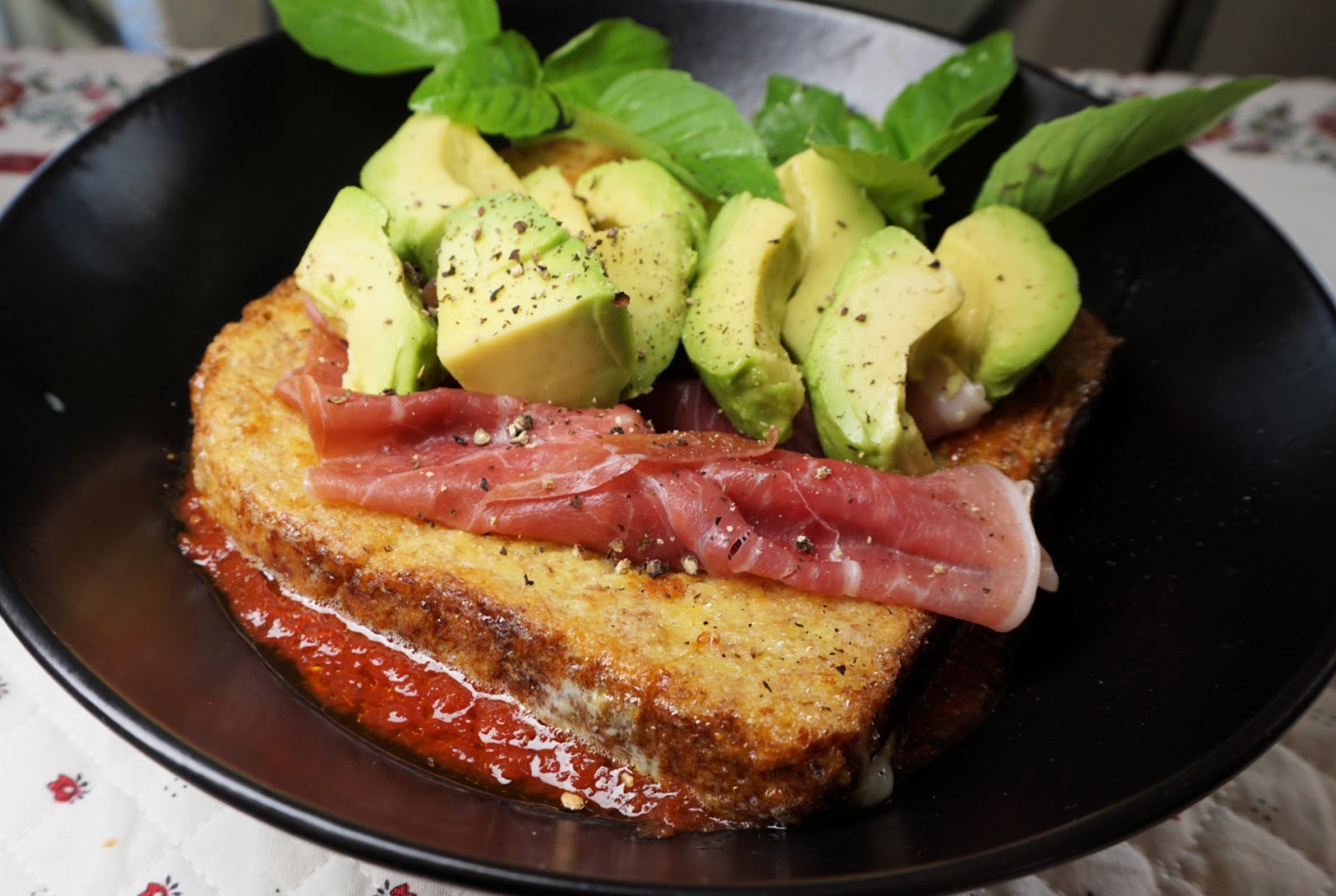 |
| French toast with Parma ham and tomato vinaigrette |
This twist of the classic French toast is inspired by a recipe of the Cheval Blanc restaurant in Paris. I have simplified the original recipe by Choosing avocado instead of green tomato sorbet and Italian passata to the tomato vinaigrette instead of making this from scratch. And of course, I use olive oil instead of butter.
This very tasty dish makes a nice lunch served with a green side salad.
2 servings
1 avocado, sliced
4 slices of Parma ham
Basil leaves
Freshly ground black pepper
For the tomato vinaigrette:
150 ml Italian passata, pref. organic
2 tbsp. good Italian balsamic vinegar
2 tbsp. tasty olive oil, pref. organic
For the French toast:
2 large slices of whole wheat toast
2 eggs
50 ml milk
Olive oil for frying
First make the tomato vinaigrette by whisking together the passata, balsamic vinegar, and olive oil. Keep in the fridge until needed.
Warm a generous amount of olive oil in a large frying pan over medium heat. Whisk together the eggs and milk and soak the toast slices in it. Fry until golden brown on both sides.
Meanwhile wash and slice the avocado.
Divide the tomato vinaigrette into two bowls and place the toast slices in the middle. Top with folded Parma ham slices, avocado, and some basil. Grind over some black pepper and serve.
 |
| Lac Miroir eastern shore |
Ceillac (1640 m) is an authentic Alpine Village in the heart of the Queyras Regional Natural Park. The renowned GR5 long distance hiking trail runs through Ceillac. The small village is surrounded by a wide valley with some agricultural and livestock activity.
Towards southeast, the Mélézet Valley is narrower, and is surrounded by steep forested mountain flanks. The GR5 trail starts to climb from Pied du Mélezet, close to a high waterfall, Cascade de la Pisse.
We have previously hiked from Ceillac along the GR5 to the Ste-Anne Lake and Col Girardin. Today’s hike was much shorter, perfect on a day when thunderstorms were forecasted for the afternoon.
 |
| GR5 from Pied du Mélezet |
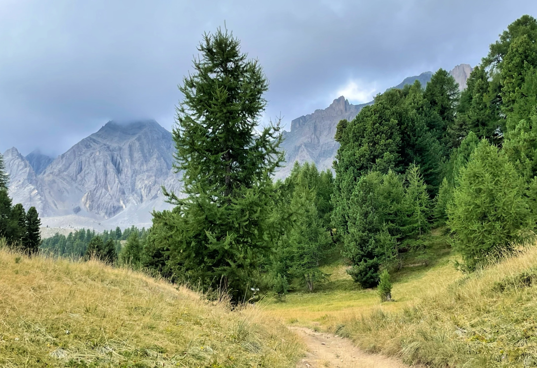 |
| GR5 near Lac Miroir |
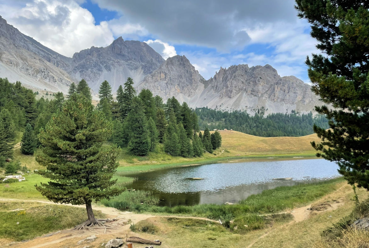 |
| Swiss pine and Lac Miroir |
From Pied du Mélezet (1680 m), we ascended steeply in the woods along the GR5. The trail did not level out until just before Lac Miroir (2214 m). It was surrounded by Alpine meadows, larches, and Swiss pines, pinus cembra. In the south, were the majestic mountain massifs of Pics de la Font Sancte (3385 m) and Pic des Heuvières (3271 m).
After the lake, we forked left at a signpost (image), leaving the GR5. We descended rapidly along a nice path, then came to a wide gravel track. Poles were good to have as the descent was steep. Some guides instruct to continue along the track all the way to the valley, to Cime du Mélezet, then back to the starting point.
We took a shortcut along a path under a ski lift, and headed directly to Pied du Mélezet.
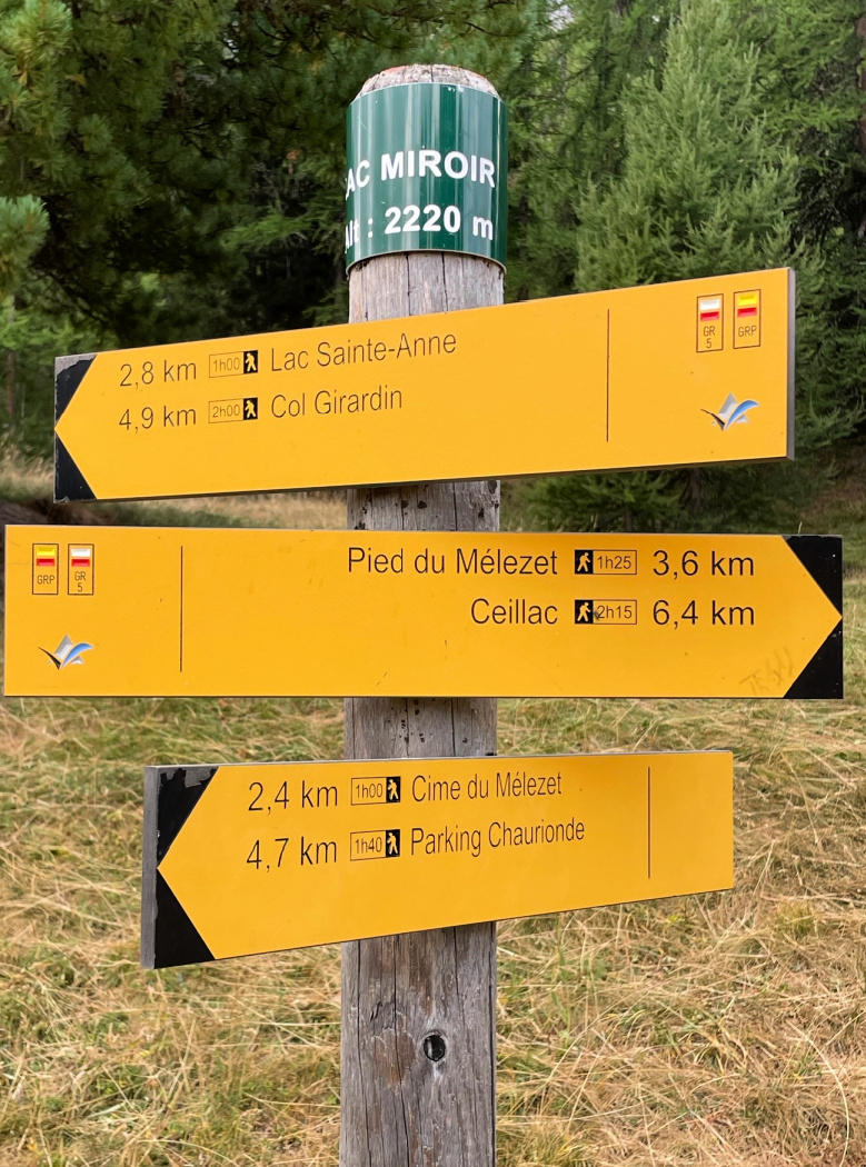 |
| Signpost near Lac Miroir |
 |
| Trail back from Lac Miroir |
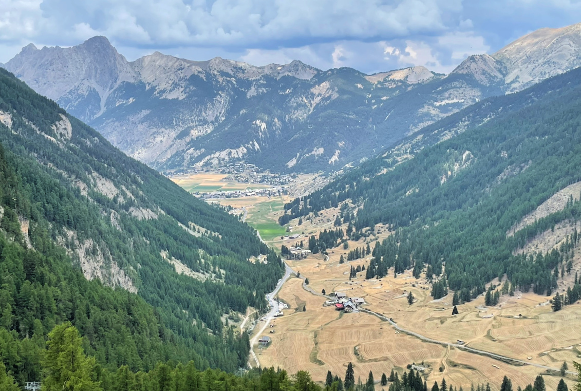 |
| Pied du Mélezet and Ceillac |
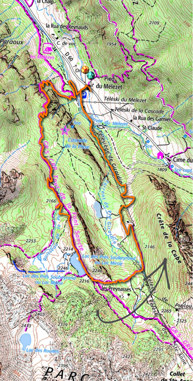 |
| Lac Miroir hike track |
For this dish, you will need very thin veal or turkey cutlets. The ones which you find in supermarkets are pretty thick but they can easily be flattened at home. Place the cutlets between two film sheets and flatten with a baking roller or by gently pounding with your fist.
2 servings
2 large and thin veal or turkey cutlets
Olive oil
For the stuffing:
A handful of chopped parsley and basil
2 tbsp. grated parmesan
2 tbsp. sliced almonds
1 tsp. capers
1 tbsp. olive oil
½ clove garlic, minced
For the sauce:
1 tbsp. olive oil
1 shallot, minced
100 ml white wine
1 tsp. Dijon mustard
Freshly ground black pepper
Preheat the oven to 200° C roast.
With a handheld mixer, purée all the stuffing ingredients. The stuffing does not need to be totally smooth. Divide it on the cutlets, fold them and fix with a cocktail stick. Place the cutlets in an oiled oven-proof dish and drizzle over a little olive oil. Roast for 20 minutes.
Meanwhile make the sauce. Warm 1 tbsp. olive oil in a saucepan over medium heat and sauté the shallot for 5- 10 minutes. Add the white wine, mustard, and some black pepper and cook until reduced.
Divide the cutlets on the plates and pour the sauce over. Serve with roasted sweet potato slices or black rice and some greens.
Col Tronchet (2661 m) above Ceillac is one of the mountain passes connecting the Queyras Region with the Ubaye Valley. It is possible to drive about 6 km in the Mélézet Valley to the very end of the narrow but paved road to a parking (not paved; at 1965 m elev.), used mainly for hikes up to the Ste-Anne Lake.
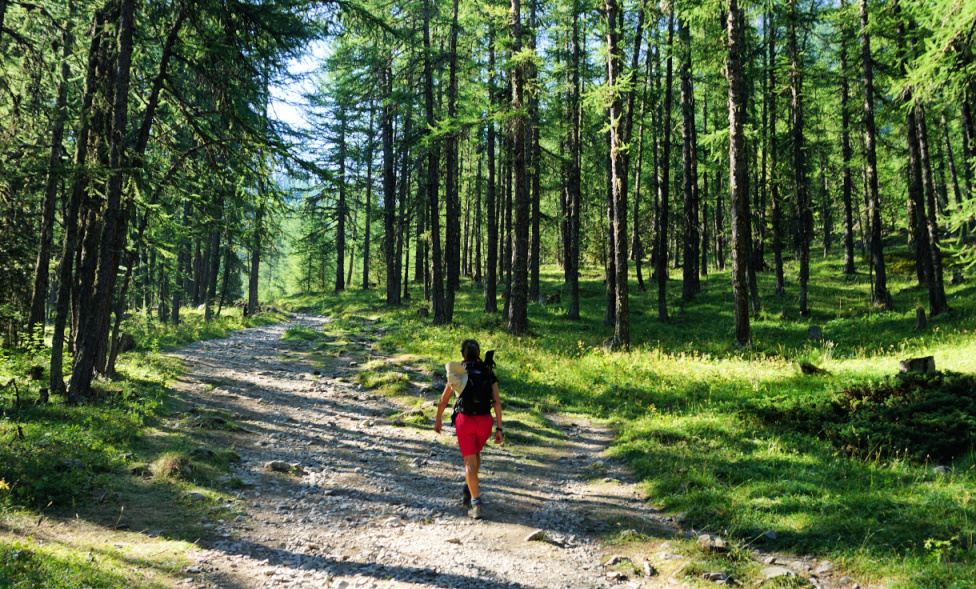 |
| Start to Col Tronchet |
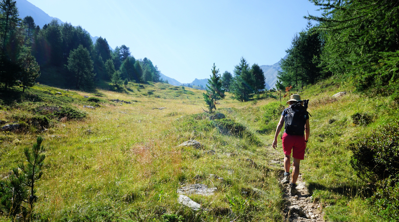 |
| Climbing to Col Tronchet |
 |
| Col Tronchet in sight |
Starting in the forest, we ascended along the main trail to about 2100 m where a signpost showed the itinerary both to the lake and Col Tronchet. We continued straight, heading to the southeast and eventually reached wide Alpine meadows, following Torrent du Tronchet.
To our right, we had Tête de Girardin (2876 m), and a bit further to the west, another ancient optical telegraph post on the ridge. Incidentally, we had visited such a post on Crête des Chambrettes the previous day. To our left, the sharp relief of Rocher de l’Eissassa (3048 m) was the only summit in the Tronchet sector reaching 3000 m.
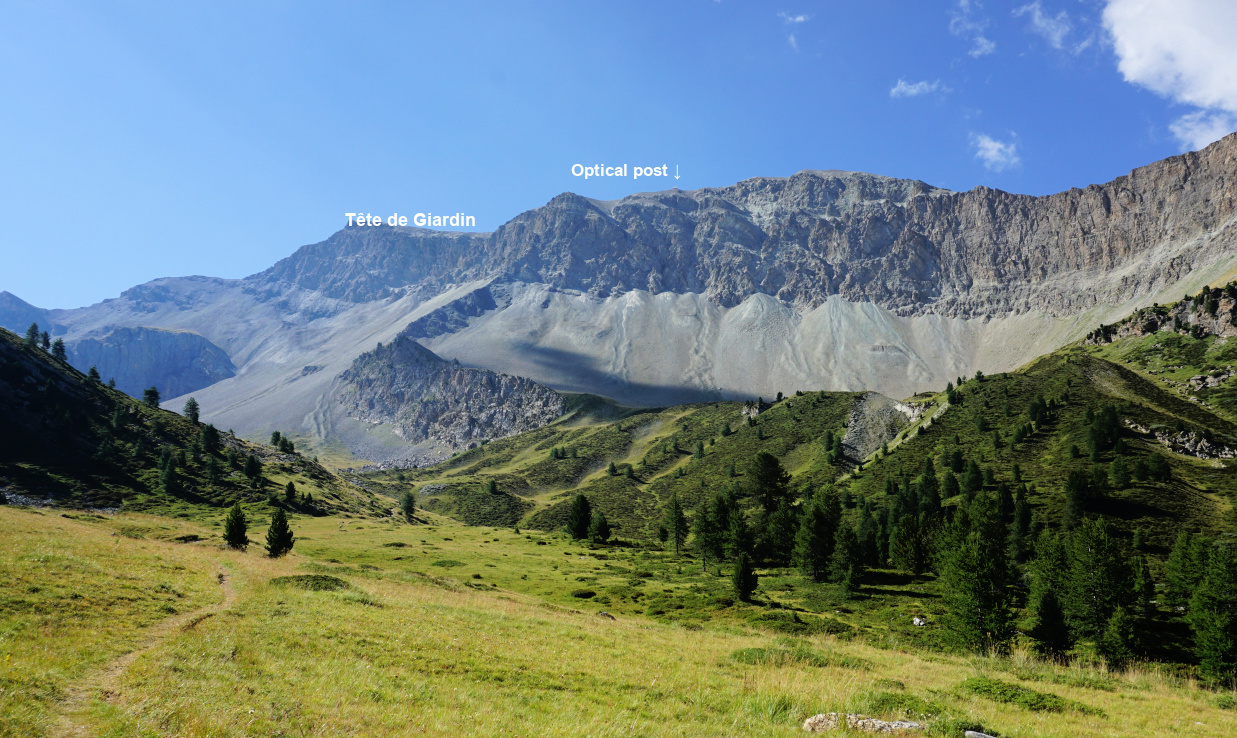 |
| Tête de Girardin |
 |
| View to west from Col Tronchet |
 |
| Descent from Col Tronchet |
 |
| Alpine meadow by the Tronchet trail |
Today’s goal had been visible in front of us since leaving the forest. Nearing the mountain pass, the meadows were replaced by rockier and steeper terrain. The solitude was remarkable. There was just a sporadic hiker on the trail.
The final ascent was quite steep and the trail was narrow. Once on the col, we had views both to Ceillac and to the Chambeyron Massif with several 3000+ peaks on the south eastern side of the Ubaye Valley. The trail continued down to Maljasset.
We descended back along the same trail.
Map: 3537ET Guillestre and 3637 OT Mont Viso
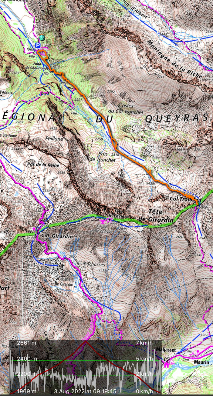 |
| Col Tronchet hike track |


