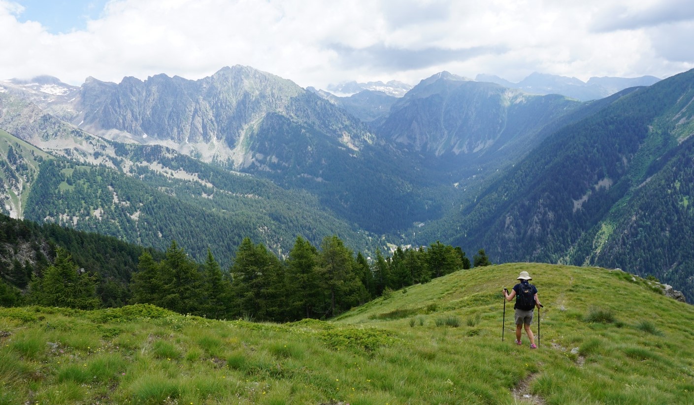
Caussols: La Colle de Rougiès


La Colle de Rougiès


The commune of Caussols (Village at 1130 m elev.) located in Grasse hinterland, northwest of Gourdon offers several interesting hiking opportunities. Paved roads reach over 1000 m elevation which makes the region popular as many of the summits and ridges can be reached with a relatively moderate effort. 

We have previously hiked to Haut Montet (1335 m; Civil Aviation Radar) which is actually located in the neighbouring commune of Gourdon.

This time we wanted to explore the ridge north of Plateau de Caussols, comprising La Colle de Rougiès (1334 m). Instead of parking by the D12 road, we drove up to Les Claps Parking where the trail to Haut Montet starts.


We walked back 200 m to signpost #43 and headed north along a wide trail, an ancient Roman Road. Several avens, sinkholes, were marked in the map next to the trail. We did not explore them as they were mostly covered with vegetation.


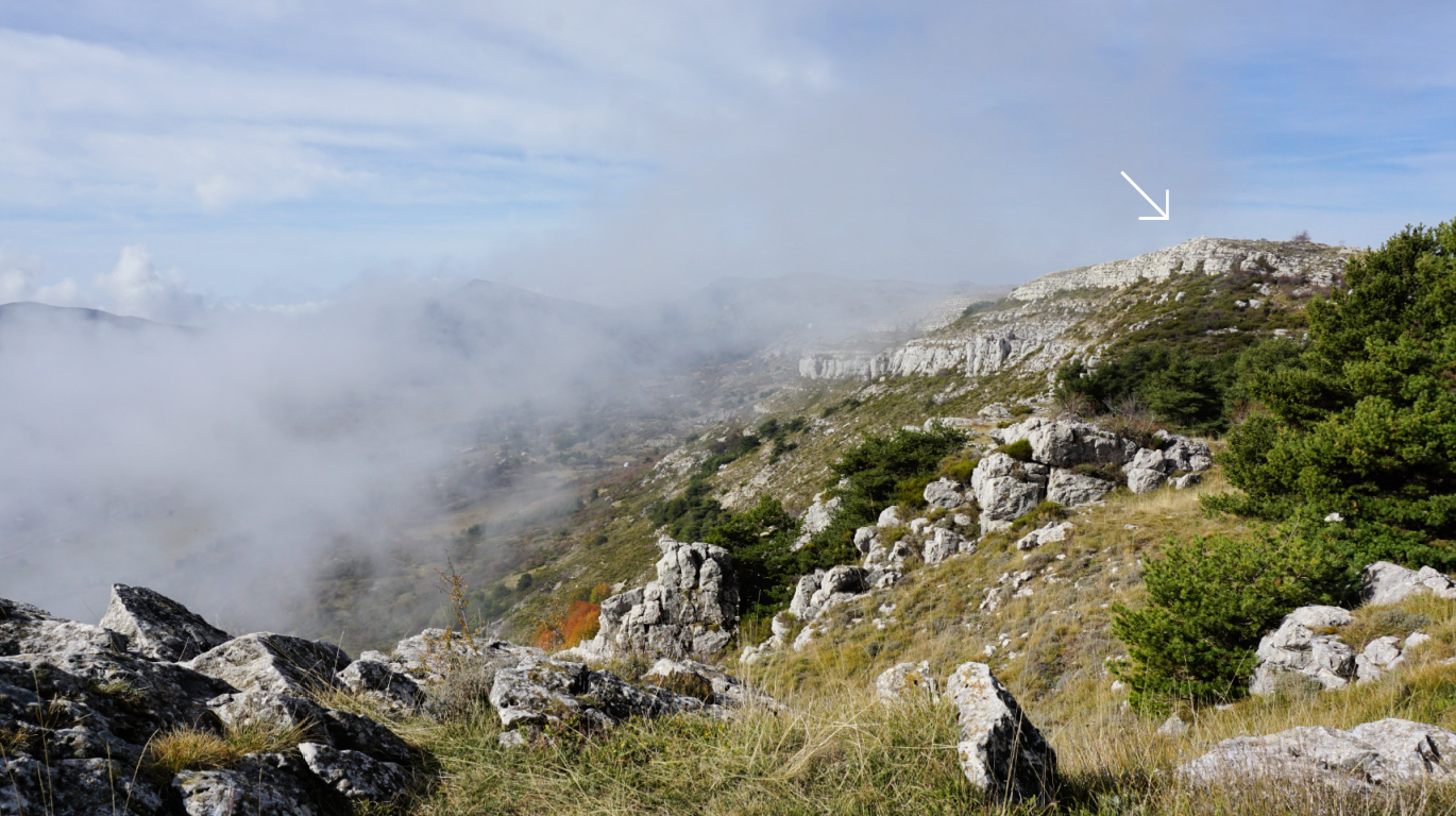
After about 600 m, we forked right (northeast) along another wide trail and soon came to the D12 road and Col de l’Ecre (1120 m). We followed the road north about 300 m to signpost #45. We forked right (east) to a marked trail and soon started to climb, eventually in a steep but short slope to signpost #46 which marked the eastern point of the ridge. Staying on the ridge, we headed west towards La Colle de Rougiès, climbing slowly mostly in open terrain, sometimes in a beautiful pine wood. The trail was soft and good.


La Colle de Rougiès summit was marked with a large cairn. In the west, we saw the Côte d’Azur Observatory on Plateau de Calern and Montagne de Thiey (1553 m) further away above the Plateau of Caussols. A wide trail continued to the observatory and beyond.


Our trail followed the edge of the ridge a few hundred meters to signpost #47. We then descended steeply, the trail was rocky and later somewhat overgrown. There were parallel markings (yellow) and cairns here and there. We came to a paved road which led us to the D12 road. We crossed it, and started to ascend along the pebbled Roman Road, Voie Romaine, which we followed back to our starting point.     


Distance: 8,5 km   


Climb: 360 m


Duration: 2h 50


Map: Cannes Grasse Côte d’Azur 3643 ET


Colle de Rougiès hike track


Ravioli gratin with tomatoes, aubergines, and chevre

Ravioli gratin with tomatoes, aubergines and chèvre


Traditional ravioli in Nice is filled with ricotta and basil or ricotta and spinach. Aubergine slices fried in a generous amount of olive oil are typical in Mediterranean recipes. If you want to reduce the amount of oil in your recipes, you can brush the aubergine slices with olive oil and roast them in oven.

Goat cheese, chèvre, gives the South of France flavour to this gratin. Instead of goat cheese you could use mozzarella which in fact melts easier.

2 servings

3 tomatoes

6 aubergine slices

1 shallot, chopped

1 clove garlic, minced

1 tsp. Provençal herbs

About 180 g full-fat goat cheese, chèvre

Olive oil

Freshly ground black pepper

Fresh basil to decorate 

Ravioli for 2 servings


Wash the aubergine and cut 6 slices about 0,5- 1 cm thick. In a large skillet, warm a generous amount of olive oil over medium heat and fry the aubergine slices until soft.


In another frying pan, warm 2 tbsp. olive oil over medium heat and sauté the shallot and garlic for about 5 minutes. Wash and chop the tomatoes and add to the pan. Add the Provençal herbs and black pepper and continue cooking.


In a large casserole, bring water to a boil. Add the ravioli to the boiling water and cook for 4- 5 minutes. Then dry them on a clean kitchen towel.


Slice the goat cheese and oil an oven- proof dish. 


Mont Ours from Ste-Agnès


Mont Ours

 Mont Ours (1236 m) above Ste-Agnès (main village at about 650 m elev.) has, as many other coastal summits, had historically a strategic importance. 

A small fortress was erected on the mountain top already in the late 19th century. When the Maginot line was built in the 1930s, several fortifications were built in the area en masse, such as the one above Col des Banquettes on the southern flank of Mont Ours.

The battle of Mont Ours took place on 12/13 September 1944, one month after the Allied landing. A commemorative plaque honouring the First Special Service Force (American and Canadian), and local resistance fighters was unveiled on the fortress wall in 2014.

Today there’s a forest fire observation post as well as several telecom masts on the summit.

Hiking trails above Ste-Agnès are numerous. You can design your own itinerary as you wish.

We have previously hiked to Mont Ours from Col de Castillon situated northeast of the mountain. We now wanted to explore the route from the south.


From Ste-Agnès village entrance parking (about 600 elev.), we headed northwest along a yellow-marked path, ascending to Pas de la Piastre (935 m elev.). Signpost #475 had disappeared but at the crossroads we took the right-hand path to Col des Banquettes (736m). The left-hand path went up to Cime de Baudon. The path descended in a pleasant forest.  

At the Col, we crossed the paved M22 road. One of the signposts #470 had disappeared (the other one was intact 70 m south).  We started to climb along the main marked path, passing some bunkers. The gradient increased and the terrain became rockier. We were guided by cairns, fading yellow markings and the digital map.

We passed signpost#472 where a wider trail went to Col de Verroux. We continued straight north to the summit. The main gate was locked but a gap was made for pedestrians. With all the installations, it was not your pristine mountain top to be honest. We were reminded of the WWII battle. The day was warm but hazy (desert dust), limiting otherwise great views.

We decided to return to Col des Blanquettes along the same trail instead of doing a loop via Col de Verroux. The 18.00 curfew had been implemented in France because of the pandemic. From the Col, we took the shortest way back to our starting point along the M22 road (very little traffic).

Hiking to Mont Ours from Col de Castillon is easier. Many hikers seem to drive up to Col des Blanquettes, starting their walks from there.

Climb: 830 m

Distance: 10 km

Duration: 4h 30 active hiking time

Map: Nice Menton Côte d’Azur 3742 OT

Mont Ours hike track


Cod surrounded with roasted vegetables


Cod surrounded with roasted vegetables


This is a great recipe in autumn and winter when root vegetables are in season. Here in Nice, you can buy good cod year- round so in summer roasted tomatoes, bell peppers, and courgettes can replace root vegetables.

2 servings

2 pieces of cod fillet, dos de cabillaud

Olive oil

1 tsp. dried Provençal herbs

Freshly ground black pepper

2 tbsp. bread crumbs

2 carrots, sliced

1 small sweet potato, peeled and cut into smallish chunks

1 parsnip, peeled and cut into smallish chunks

1 small onion, chopped

1 clove garlic, minced

A few broccoli florets, microwaved

Fresh herbs and lemon wedges


Preheat the oven to 200° C, roast.


Microwave the carrot slices for a few minutes because they take the longest to roast. Place 2 tbsp. olive oil in a plastic bag and add the vegetables except broccoli. Give the bag a good shake and pour the vegetables in a large oven-proof dish in single layer. Roast for 30 minutes until soft.


Meanwhile make a crumble by mixing the bread crumbs, dried herbs, some black pepper, and olive oil. Coat the cod pieces with this crumble and place in the middle of the roasting dish. Continue roasting for 10- 12 minutes, depending on the thickness of cod. Microwave the broccoli florets for a few minutes until soft.


Divide the cod and vegetables on the plates and decorate with chopped fresh herbs. Serve with lemon wedges.


Collet St-André above Bonson


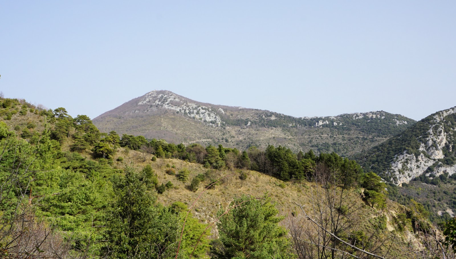
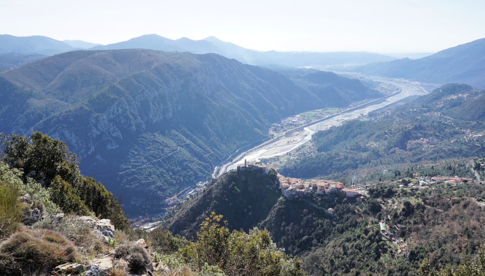
The village of Bonson is perched high above the Var River Valley, but even higher is the sharp mountain top of Collet St-André (757 m). In spite of much higher summits in the vicinity, it dominates the scenery when driving north from Nice.

A marked trail zigzags to the summit along the mountain’s somewhat less steep western flank. 

On a gorgeous winter day, we drove through the village of Gillette, and turned towards Revest-les-Roches along M227. After 2.8 km, we parked by the road near signpost #38 at a place named Collet des Sousses (elev. 626 m), our starting point (see map below).


We headed east, towards Baisse du Collet St-André along a forest trail. Unfortunately, the original trail had disappeared after a rock/mud slide, and we had to take a marked detour. This stretch was muddy and wet, but we reached the good main trail soon enough.

We came straight to Baisse du Collet St-André (signpost #28 at 606 m elev.), and started to climb, passing a rock-climbing site. The gradient increased and some scrambling was needed in the end. We were rewarded with excellent views, and a flock of griffon vultures happened to circle the mountain top.

We descended carefully and took the same trail back to our starting point. As expected, it was an off the beaten track itinerary. If you wish to avoid the short muddy part of the trail, it is best to drive to Bonson and simply climb up from there.

Distance: 5.2 km

Duration: 2h 20

Climb: 320 m

Map: 3642 ET Vallée de l’Estéron

Collet St-André hike track

Signposts#38 and 28


Thon mi-cuit with capers and lemon sauce

Thon mi-cuit with capers and lemon sauce


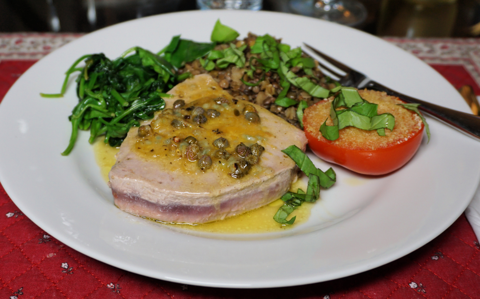
Thon mi- cuit, half-cooked tuna, is an excellent way to prepare fresh tuna steaks. Tuna steaks are cooked in the same way as you would tender steaks; to medium rare perfection. The steaks are cooked on the outside but left pink, even red, on the inside.

The cooking time depends on the thickness of the steaks. The tuna steaks we normally get here in Nice are about 2 cm thick so about 1,5 minutes, or even a bit less, cooking on each side over medium heat is long enough. Watch the steaks while sautéing them so as not to overcook.

Reduced lemon- caper sauce goes well on top of the steaks. In the photo, the tuna steaks are served with lentils, roasted tomatoes, and wilted spinach but feel free to choose the vegetables as you wish.

2 servings

2 fresh tuna steaks

1 organic lemon, juice and zest

Olive oil

2 tsp. capers

1 clove garlic, minced

Freshly ground black pepper

For the vegetables:

100 ml blond lentils or lentil mix

Water

A bag of baby spinach leaves

1 tomato

About 2 tbsp. bread crumbs

Chopped fresh basil


Start by cooking the lentils which takes about 20 minutes.


In a steel frying pan, warm 2 tbsp. olive oil over medium heat and sauté the tuna steaks about 1,5 minutes on each side. Transfer to a plate and cover to keep warm.


Add 1 tbsp. olive oil to the pan and sauté the garlic about 1- 2 minutes. Add the lemon juice, lemon zest, capers, and black pepper. Turn the heat a bit higher and let reduce somewhat.


Meanwhile roast the tomato halves and wilt the spinach.


Divide the lentils, tuna steaks, tomato halves, and spinach on the plates. Pour the lemon- caper sauce over the tuna and decorate with chopped basil. 


Le Boréon: Forest path above the Salèse Valley


Trail above the Vallon du Champet Boréon


The following loop hike is for forest lovers. Even though this itinerary mostly runs in the woods, there are several open stretches with great views down to Le Boréon (1500 m) as well as the Salèse  and Vésubie River Valleys. Le Boréon 6 km north of St-Martin Vésubie is one of the most popular hiking areas of Alpes-Maritimes.

A paved but potholed road M89 goes up to the Salèse Valley parking (1690 m), bordering the Mercantour National Park. The most popular trail, the GR52, continues from here to north west to Col de Salèse.

Note that after the devastating storm Alex in early October 2020, all access to Boréon was cut. Currently there’s a very limited access (not for the public) as far as to the Lake Boréon. It remains to be seen if the connection can be established before the next summer.

From the Salèse Parking, another trail goes up to Lac des Adus and beyond. We have previously hiked to Mont Archas in this area.

 The weather forecast for today’s hike was showers and thunderstorms in the afternoon (did not happen though!), and we wanted to avoid higher terrain. Besides, the forest above the Salèse Valley is most beautiful.

Signpost#397 and trail start

We crossed the stream along a wooden bridge to signpost #397 (Refuge et Lac des Adus etc). The climb in the forest was continuous. Just before the refuge, at signpost #396, we forked left(south) along a path that undulated in the verdant lower eastern flank of Mont Archas. Our trail connected with the trail descending from Mont Archas at signpost #393 (2242 m; the highest point of this hike). From this part of the trail, the views were excellent. 


Forest path above Salèse Valley

Steep trail to Lac des Adus

Path in les Petits Adus above Boréon

Path under Mont Archas


We descended rapidly, first along alpine meadows (above Serre Long), then again in the forest (Vallon du Champet) to signpost #391 where we forked left (north) to signpost #390. At signpost #398, we joined the GR52 and followed it back to our starting point, ascending about 110 m.


This itinerary was easy to follow. The paths were easy to see, markings were in yellow and the signposts clear.


View from trail over Salèse Valley


Mont Archas


Trail near Serre Long Boréon


Le Boréon


Vésubie Valley seen from Serre Long


Climb: 780 m 


Distance: 9 km


Duration: 4h 10 active hiking time


Map: Vallée de la Vésubie 3741 OT


Boréon forest loop track