Tortilla tart recipe

Tortilla tart recipe


This tortilla tart recipe is inspired by a lunch in Miami when we were served a super salad in a pizza bottom case. The pizza case acted as a kind of bowl and consequently it was a bit too hard to eat. But it was very decorative.

So I thought why not make a tart in the same way and instead of pizza bottom use a tortilla which is thinner. The filling in this recipe uses typical Mediterranean ingredients. This easy, carefree tart is worth trying, and makes a nice lunch for two.

For this recipe you need a non-stick 20 cm tart case.

Ingredients

1 wheat tortilla
3-4 medium ripe tomatoes
100 g ricotta
50 ml crème fraîche 15 % fat or cream for cooking
2 eggs
A handful of fresh spinach leaves
About 50 g pecorino or other half-hard goat’s cheese
8 black olives
2 tbsp olive oil
Black pepper

Preheat the oven to 180⁰ C.

Cut the tomatoes in quarters and place them in an ovenproof dish. Sprinkle with olive oil and grind over some black pepper. Bake in oven for 30- 45 minutes until the tomatoes are “collapsed”.

With a fork crush the ricotta and mix with crème fraîche. Whisk the eggs and add the ricotta- crème fraîche mixture into the eggs. Grind in black pepper. Remove the stones from the olives, if necessary, and set aside.

Line the tart case with the tortilla taking care that the walls are covered as well. Pour the egg-ricotta-crème fraîche mixture into the tortilla case. Place the tomato quarters and black olives on top.  Bake the tart for 20- 25 minutes.

Wash and dry the spinach leaves. Cut them into strips. Remove the tart from the oven and sprinkle the spinach over it. Slice pecorino shavings over the tart and serve with a green side salad.

Day hike in Queyras from Ceillac to Col Girardin


Starting the hike from Pied du Mèlèzet

It was Bernard Ranc’s wonderful hiking book, Les plus belles Randonnées des Alpes du Sud, which gave us inspiration to this hike near Ceillac in Queyras Regional Nature Park.

GR5 trail from Pied du Mèlèzet


From Nice, we drove over Col de la Bonette and Col de Vars as far as to Guillestre, then up to the small village of Ceillac (4 hours from Nice). We had booked the Hôtel Cascade in Pied du Mèlèzet in the Mèlèzet Valley a couple of kilometers from Ceillac because of its super location. It was great to start the hike along the GR 5 trail straight from our hotel door! The surrounding countryside was quiet, La France Profonde at its very best.
Lac Miroir 2214 m


The GR 5 trail ascends steeply in the woods from Pied du Mèlèzet (1670m).After that the trail levels off a bit, turns south, and after about 1h 50 from the start you will reach Lake Miroir (2214m). From here, the GR 5 trail continues southeast ascending to  the Collet Ste- Anne (2408m). Part of the trail here follows a ski run. The impressive peaks of Fonte Sancte (3385m) are visible above the trail.
The GR5 trail just before Lac Ste-Anne Pics de la Font Sancte 3385m in background


Lake Ste-Anne (2403m) is reached soon. When you see its turquoise water for the first time, you understand why it is considered one of the most beautiful mountain lakes in the region.

Lac Ste-Anne

GR 5 continues southeast ascending in a high alpine landscape towards Col Girardin (2699 m). At the mountain pass there is a trail that forks left to Tête de Girardin (2875 m), an option if you wish to climb 176 m more. We returned from the Col along the same trail to the Lake Ste- Anne. There we turned northeast following the trail (yellow marks) to the upper parking in the valley at 1967 m. From there, we descended following a path in the Mèlèzet Valley back to Pied du Mèlèzet, our starting point.
GR5 trail near Col Girardin
Total ascent:  1029 m

Duration:          6h 30


Col Girardin and the trail leading to Tête de Girardin


Map: IGN 3537 ET Guillestre
Image of route


Image of itinerary courtesy of Google Maps


Green risotto recipe

Green risotto recipe


There are many ways to vary the basic risotto (See: risotto with scallops May 2015 + risotto with shrimp Jan 2014). In Italy they even make black risotto from octopus.

The green colour of this risotto from pea purée and baby salad leaves and the pink colour from smoked salmon bring summer to the table. Instead of smoked salmon, you could use cooked shrimp or prosciutto di parma.

2 servings

About 120 g smoked salmon, cut into strips
100 ml frozen peas
100 ml water
A generous handful of baby salad leaves, cut into smaller pieces
2 tbsp olive oil
For the risotto:
120 ml risotto rice
700 ml vegetable stock (you may not need to use it all)
2 tbsp rapeseed oil
1 shallot or small onion, minced
1 clove garlic, minced
150 ml white wine
100 ml freshly grated parmesan
Freshly grated black pepper
½ lemon, cut into very small pieces

First make the pea purée. Cook the frozen peas in equal amount of water for about 10 minutes and purée with a hand-held mixer. Set aside.

Cut the salmon, baby salad leaves and ½ lemon and keep in the fridge until needed. Grate the parmesan.

Cook the risotto the classic way by adding small amounts of liquid and stirring constantly for 25 minutes. A detailed description of how to cook the perfect risotto is found in our previous posting: Risotto with scallops, May 2015, see above.

When the rice is cooked, add the pea purée, parmesan and the lemon pieces, and adjust the consistence. Add the baby salad leaves and mix. Divide the risotto into bowls or risotto plates, top with smoked salmon and drizzle with olive oil.

La Tête de Vinaigre

St-Dalmas-Le-Selvage

On the GR5 trail from St-Dalmas-Le-Selvage-to-Col-de-la-Colombière
Bousièyas, Camp des Fourches and Cime de la Bonette far left in distance
The small village of Saint-Dalmas-Le-Selvage is the centre of the highest commune in Alpes-Maritimes. It is better known as a cross-country skiing centre, but in the summer it is an excellent starting point for several hikes.

Climbing from Col de la Colombière towards Tête deVinaigre


The village is quiet, no-nonsense, and is situated in a formidable environment. The sheep-raising tradition is still very much alive in Saint-Dalmas-Le-Selvage, and in the neighboring hamlets Pra and Bousiéyas. In summertime huge sheep herds are taken to and from grazing grounds at higher altitude.
Tête de Vinaigre in sight


Today’s hike starts from signpost 68 at the village entrance. The main parking is in the other end of the village. Most of the trail is actually a tiny part of the mythic GR5 trail; hence follow the white and red signs to signpost 48 just above the village. From here the continuous ascent starts towards Col de Colombière (2237 m). After about 40 minutes, the trail enters the Mercantour National Park.
Mont Tenibre 3031 m seen from Tête de Vinaigre


Navigation is easy. The whole trail runs in an almost treeless environment. In spite of the altitude, it can be very hot on a sunny summer day. For this hike, two liters of water plus 600 ml of sports drink to supply electrolytes was just enough for an average guy. We drink at the start, then every 30 min, and snack on salty nuts and fruits.
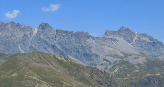
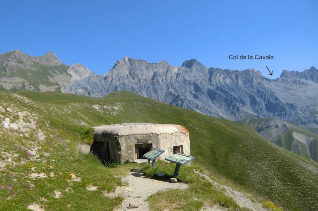
Tete de l'Enchastraye far right and Col de la Cavale seen from Tête de Vinaigre


A few sheep herder’s huts are close to the trail. On the day of our hike, dogs guarding the flock made their presence known without being directly menacing, and kept their distance.

Image of itinerary

The last push to Col de Colombière is a bit steep. The trail zigzags to signpost 47, located at the mountain pass. This is also the crossroads where GR5 continues north descending to Bousiéyas, the left hand trail goes up to Crête de la Blanche, explored by us earlier. Our trail forks right (to east) ascending to Tête de Vinaigre (2394 m). From the summit, almost all major peaks of northernmost Alpes-Maritimes are visible, including Mont Tenibre (3031 m). In the northwest, the cone-shaped Cime de la Bonette (2860 m) can be seen.


We used the same trail back to Saint-Dalmas-Le-Selvage.


Total elevation gain:                  900 m

Duration:                                  2h 45 climbing, 2h descent

Map:                IGN “Haute Tinée” 1 3639 OT

Distance from Nice:                 98 km/ 1h 40

Image of itinerary courtesy of Google Maps


Summer vegetable gratin recipe

Summer vegetable gratin recipe


This summer vegetable tian is great with grilled lamb chops or brochettes d’agneau ou boeuf, lamb or beef skewers. This gratin is made from only summer vegetables, so it is not a traditional Provencal tian which also contain eggs, cheese and often rice.


2- 3 servings:


1 onion, thinly sliced
1 clove garlic, minced
2 large tomatoes, thinly sliced
1 large courgette (green summer squash), thinly sliced
1 aubergine, thinly sliced
A small bunch of fresh thyme
About 3 sprigs fresh rosemary
1 bay leaf
3 tbsp olive oil
Freshly ground black pepper
Fresh basil leaves to decorate

Preheat the oven to 200⁰ c.

Oil the gratin dish liberally with 1 tbsp olive oil.

Peel and thinly slice the onion. Place the onion slices in the bottom of the gratin dish. Peel and mince the garlic clove and scatter it on top of the onion. Scatter the thyme leaves and place the bay leaf on top of the onion.

Wash and dry the tomatoes, courgette and aubergine. Slice them thinly. Cover the onion, garlic and herbs with the slices, packing them quite tightly and alternating them. It doesn’t matter if you have some leftover vegetable slices; you can fry them next day in olive oil for a vegetable side for lunch or dinner.

When you have packed the vegetable slices in the gratin dish, grind over some black pepper, place the rosemary sprigs on top and sprinkle 2 tbsp olive oil over the dish.

Bake in oven for 1 h- 1h 15. Cover the gratin dish with tin foil after 30 minutes so that the vegetables do not become too dry.

Camp des Fourches to Col de la Cavale

Col de la Cavale seen drom Col des Fourches


Valley of Salso Moréno

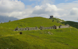
From Camp des Fourches (2240 m alt., 102 km and 1 h 45 from Nice), a few km before Col de la Bonette, you have a choice of three different day hikes, each about 4 hours. At Camp des Fourches there are just ruins of an old caserne and a parking, nothing else. But the surrounding scenery is stunning.
The area around Camp des Fourches is summer pasture for sheep


You can climb to Cime de Pelousette (2757 m), to Col de la Cavale (2671 m) or you can explore the peculiar valley of Salso Moréno up to Col de Pouriac (2506 m). The valley of Salso Moreno is a summer pasture to huge sheep flocks. An altogether more strenuous option is the ascent to Tête de l’Enchastraye (2954 m), which takes at least 7 hours.
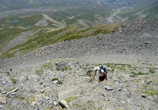
Ascending towards Col de la Cavale along GR5


On the day of our hike the heat wave had reached France, and the temperature even at Camp des Fourches was approaching 20 degrees at 10 o’clock in the morning. We opted for Col de la Cavale along the GR 5 trail. From the parking, there’s a 5 minute walk to Col des Fourches (2261 m). The trail that forks left from here goes to Cime de Pelousette whereas another short path goes straight south climbing to the nearby Mont des Fourches (2342 m), about 30 minutes one way.
Approaching Col de la Cavale


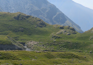
Our GR 5 trail descends about 180 m to the beginning of the Salso Moréno Valley. Its geological wonders include several dolines or sinkholes. With almost no wind and temperature soaring, we certainly looked forward to the cool mountain wind higher up, and were not disappointed. The trail passes a tiny refuge, goes over a dry riverbed before reaching signpost 37. From here, our GR 5 route forks left, and continues ascending almost straight
Cime du Mul seen from Col de la Cavale
north. The final ascent to the col is steep but is nevertheless easy to negotiate especially if you have poles. No scrambling is necessary. From Col de la Cavale, the GR5 trail continues north to the Lauzanier valley, and eventually to Col de Larche.


We descended along the same route. Col de la Cavale is an excellent spot for a break in good weather.
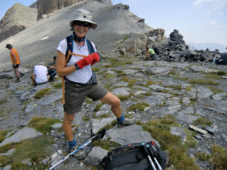
At Col de la Cavale


Total ascent:                     780 m


Duration:                          4h 30 (2h 30 climbing, 2 h back)

Map: IGN 3639 OT Haute Tinée 1


Image of itinerary :
(Courtesy of Google Maps)


Beef fillet recipe with courgette cake

Beef fillet recipe with courgette cake


A few years ago it was easy to find tender pre-packed entrecôte or sirloin steaks in our local supermarket in Nice. But nowadays you have to go to a butcher for tender steaks. Luckily the pre-packed beef fillet, tenderloin, filet de boeuf, is just as tender and tasty as it used to be. Yes, this is luxury, but sometimes it is better to have something really good, but seldom and in smaller portions.

The following recipe is easy and carefree to make on a hot summer evening. It is adapted from a French magazine and results in a rare to medium rare fillet, which reminded me of the classic Carpaccio. If you prefer your fillet medium or well done just extend the cooking time in the oven. The amount of fillet is for four persons or for two with generous fillet leftovers for a beef salad the next day. It is easy to double or treble the courgette cakes for a larger party.

2 servings

For the fillet: 4 servings or 2 with leftovers
About 500 g beef fillet, filet de bœuf
1 clove garlic, minced
About 3 sprigs parsley, minced
1 tbsp dry bread crumbs, chapelure
Freshly ground black pepper
About 2 tbsp olive oil

For the courgette cakes:, ingredients for 2 cakes:
1 medium green courgette, grated
1 egg
A small handful of freshly grated parmesan cheese
2 sprigs of parsley, minced
Freshly ground black pepper
A pinch of salt
1 tbsp rapeseed oil for the frying

For the mayonnaise:
2 tbsp good mayonnaise
1 tsp Dijon mustard

Plus you need two small handfuls of baby salad leaves.

Preheat the oven to 180⁰ C.

Mince the parsley and garlic; add the breadcrumbs and black pepper and mix in a bowl. Spread this mixture on a plate. French fillet often comes covered with a slice of lard, remove this. Oil the fillet on all sides with olive oil and roll it in the parsley-garlic-bread crumb mixture. Place the fillet in an ovenproof dish and cook in the oven for 20 minutes for rare to medium-rare. Take the fillet out of the oven, place on a cutting board and cover with tin foil for 10- 20 minutes.

While the fillet is in the oven make the “batter” for courgette cakes. Wash and dry the courgette. Then coarsely grate it. Mince the parsley and finely grate the parmesan. In a bowl whisk the egg, add the parsley, courgette, parmesan, black pepper and a pinch of salt. Add enough of grated courgette to get a thick “batter”. Mix well. You may not need to use the entire grated courgette, if you have leftover courgette you can use it the next day in an omelette.

While the fillet is resting on the cutting board cook the courgette cakes. In a frying pan warm 1 tbsp rapeseed oil over medium- high heat. Place two heaps of courgette “batter” in the frying pan and flatten a little with a spatula to make two cakes. Cook for 4 minutes, then turn and continue cooking for 3- 4 minutes. Transfer on a plate and keep warm by covering with tin foil. If you cook several courgette cakes, you need to do this in batches.

Mix the mayonnaise with mustard in a small bowl. Slice the fillet into thin slices.

Place the courgette cakes on the plates. Place a few fillet slices on top of the cakes and the rest on the side. Add the salad and mayonnaise on the plates and serve.

Lunch at Auberge de la Madone and our Peillon classic walk


The terrace of Auberge de la Madone
Entrance to the restaurant of Auberge de la Madone

This hike from the perched village of Peillon (372 m), about 20 km north of Nice by road must have been one of the first hikes in the region that our family discovered almost 10 years ago. That is why we call it “Peillon classic”. In the Randoxygéne guide it is called Circuit de Lourquière.


First intersection on the trail just after Peillon

Today we didn’t start the hike from La Grave-de-Peille, but made a shortened walk from Peillon around the hill called Pointe de Lourquière (678 m), because we first wanted to have lunch on the terrace of hotel-restaurant Auberge de la Madone. This family restaurant has long been known for its great cooking following local traditions, and seems to get favourable reviews on Trip Advisor. We chose formule bistro, three courses for 25 €, and were not disappointed.

The trail after the bridge continues to Peille


The walk starts from the centre of Peillon, from the parking in front of Auberge de la Madone. Turn left after the fountain at the village entrance; ascend first along a narrow street passing the cemetery. You will soon find the signpost “
La Grave de Peille and Peille Village . The trail ascends gently in a beautiful valley. After about 30
min, a crossroads is reached. The trail north goes over a stone bridge to Peille. However our itinerary turns right ascending to a paved road and a nice residential area called plateau des Lacs (about 600 m alt.). Follow this road about 2 km south. The point where the trail forks right and leaves the road is clearly signposted. The whole trail is marked with yellow. It descends slowly to Vallon St-Martin before a final short ascent back to Peillon.
The trail of Circuit de Lourquière is good

Approaching Peillon


Image of the itinerary:
(Courtesy of Google Maps)


Total walking time when starting from Peillon: 2h 15 (Circuit de Lourquière about 4 h)
         
Ascent:                                                               270 m (Circuit de Lourquière 460 m)


Authion today and 70 years ago

Cabane de Tueis seen from the GR52 trail


Redoute fortress at Point des Trois Communes

Authion comprises several about 2000 meter high mountain tops in the southernmost part of the Alps. The Mediterranean coastline is about 25 km away. The region is now part of the Mercantour National Park. Situated just above Col de Turini, Authion is easily reached by car. There’s a loop road permitting one-way counterclockwise traffic during the summer season. The most rewarding way to explore Authion is by foot. Most of the trails are easy and as you can start from a higher altitude not that much climbing is needed.
View towards Moulinet from the road to Cabanes Vieilles


Authion has been of great strategic importance for hundreds of years, and was part of the Maginot Line. Several ruined forts and casernes remind the visitor of the turbulent past. At the very end of WWII, Authion remained one of the last German strongholds. In April 1945, General De Gaulle ordered the French troops to attack these positions. A sole American-made Stuart tank was deployed and it can still be seen at Cabanes Vieilles. The battle raged for two weeks. The French lost 280 men and about 1000 were wounded whereas Germans lost about 100 men before withdrawing. The armistice was just a few weeks away.
The American built Stuart tank at Cabanes Vieilles


The walk starts at Cabane de Tueis (also called chalet Charles Alési, 1889 m), at signpost 244. The trail marked as GR 52 ascends along a ridge to 2065 m. The Redoute fortress (2080 m) at Point des Trois Communes is clearly visible from here. Signpost 410 which is just below the fortress is reached rapidly.

Our trail then leaves the GR 52, and descends in an alpine meadow to Plan Caval that is already visible.
Descending from Fort des Mille Fourches to the road of Authion
From here, you continue along the paved loop road as far as to Cabanes Vieilles (1780 m). The road has very little traffic. At Cabane Vieilles, you can see the tank used in the final battle in April 1945. From this point, the itinerary goes almost straight north passing some caserne ruins, then ascending quite steeply in a larch wood followed by an alpine meadow (The direction is evident but there isn’t really a path to speak of ) as far as Fort des Milles Fourches (2042 m).  A small descent then takes you to the loop road again.
Cabane de Tueis or Chalet Charles Alési

The route then climbs a little bit to Fort de la Forca (2078 m,) before continuing to the GR 52 trail used in the beginning of the hike. From the last intersection, the starting point can be reached in 15 minutes.
However, on the day of our hike, dense clouds descended from north when we were nearing Fort de la Forca making the visibility poor. We therefore decided to take the road directly back to Cabane de Tueis. The shortcut made the walk 30 min or so shorter, and we also climbed 100 m less.

Map: IGN 3741 ET Vallées de La Bévéra et des Paillons

Duration         3h 30

Climb:            450 m

Image of hike itinerary:

(Courtesy of Google Maps)


Peach Melba recipe

Peach Melba with a modern twist


This is a modern, healthy twist of  Peach Melba. The classic Peach Melba is made from peaches, raspberry sauce and vanilla ice cream. The dessert was invented by the French chef Auguste Escoffier in the 1890s' in London to honour the Australian soprano Nellie Melba.

This version is less sweet and contains very little fat and is served in a glass, en verrine. This dessert is especially tasty when peaches are at their best. If you cannot find frozen raspberry sauce or grilled sliced almonds in your area, you have to start making these yourself. Otherwise this dessert can be put together in a few minutes.

2 servings

2 fresh and ripe peaches
2 tbsp raspberry sauce, coulis de framboises
4 tbsp low-fat fromage blanc or thick plain yoghurt
1 vanilla pod
Grilled almond slices

Defrost the frozen raspberry sauce and keep it in the fridge.

Half the vanilla pod lengthwise and scrape the seeds into the fromage blanc or yoghurt. Mix well and keep it in the fridge.

Wash and dry the peaches. Cut them into very small pieces.

Start filling the glasses with about half of the peaches followed by a layer of about half of the fromage blanc or yoghurt. Then again a layer of the rest of the peaches followed by a layer of fromage blanc or yoghurt. Top with raspberry sauce and grilled almonds. Serve at once.