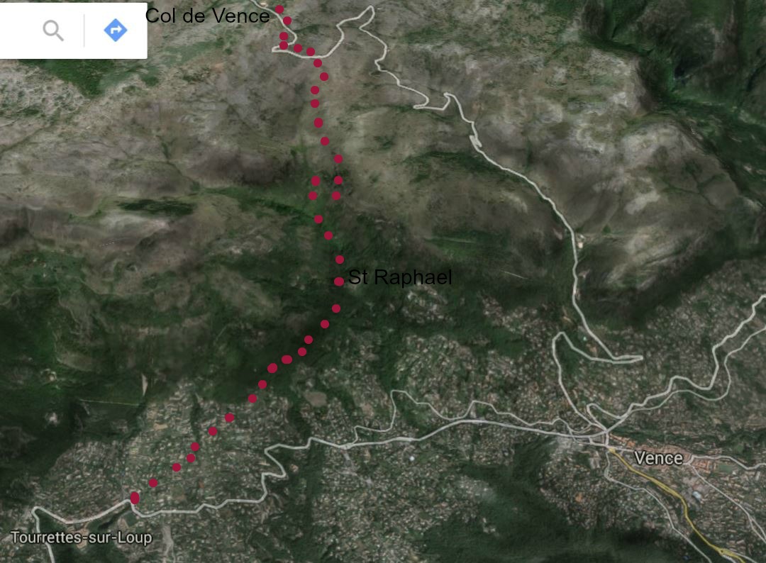
February hike above Tourrettes-sur-Loup

The trails above Tourrettes-sur-Loup and Vence are popular winter walks.
We started our hike from the spacious parking at the entrance of Tourrettes-sur-Loup (396 m). Heading to Col de Vence (962 m), we first followed the trail ascending to Chapel St-Raphael and Gué du Malvan. The trail marked with yellow signs first ascends in an affluent neighbourhood, and then continues in a beautiful small forest.
Chapel St-Raphael is reached in about 50 minutes. It is situated on top of a small hill on the right hand side of the trail. We made a short detour to the chapel (closed) before continuing to Gué du Malvan, a tributary of the River Cagnes. Soon after the crossing, we joined the GR51 trail (red/white signs), turned right at the signpost, and started to follow the GR51 heading to Plan de Noves.
At the western part of Plan de Noves(a plateau and a Parc Départemental), the trail to Col de Vence forks left, eventually crossing the RD2 road twice. This trail is well marked with yellow in addition to some cairns, heaps of stones. After the second road crossing, the trail continues a bit following the road, then joins the RD2 just before Col de Vence. We walked along the narrow road, crossed it for the third time and found ourselves on a rocky field. From this point, we admired the snow-capped Mercantour peaks.
All in all, this is a great winter hike on a clear day. Climbing up as far as to Col de Vence does not actually add much scenery wise, and you have to cross the narrow road with surprisingly much traffic. One option is to go as far as to Plan de Noves and turn there. There are no steep parts on this walk, and the trail is well marked.
We descended along the same trail.
Total hiking time: 4h 20
Ascent:About 600m
Map: IGN Cannes Grasse 3643ET
Image of trail courtesy of Google Maps


0 comments:
Note: only a member of this blog may post a comment.