Col de Turini
The most magnificent forests in Alpes-Maritimes are situated around Col de Turini (1604 m), although the mythic mountain pass is better known from the Monte Carlo Rally. The special stage from la Bollène-Vésubie up to Turini is one of the most famous rally stages in the world. Drive the road yourself and you’ll get the feeling.
Today, however, we came here to explore the nature. The hike starts from the parking of col de Turini next to the Hôtel des Trois Vallées.
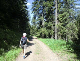
Start descending from signpost 195 along GR52A along a wide forest road. After 45 minutes, the trail leaves GR52A, forks left in the forest and starts ascending. The trail here is good, but was obstructed by several fallen trees. The mountaintop of Cime de Suorcas (1516 m) is reached in about 50 min. In spite of the “modest” altitude the views were great even though the coastline was not visible because of the haze. After having visited this little summit the trail continues east along a forested ridge passing two mountaintops called Tête de Gaglio (1568 m) and Tête de Francha (1608 m). Near the latter peak, there was a short steep section where metal ladders and a rope had been attached to facilitate the climbing.
The trail continues east, passes a hut and crosses the D2566 road. The last ascent goes to Cime de la Calmette (1786 m) before descending back to the starting point along a good trail. Follow the path east (yellow marks) after passing an abandoned ski lift, then turn northwest to signpost 32 from where the starting point is reached in a few minutes. Our descent seemed to coincide with the cows’ descent back to col de Turini. They were on their own, and seemed to follow their internal clock!
After the hike we enjoyed coffee and blueberry tart at the terrace of the Hôtel des Trois Vallées. Inside, you can find lots of pictures from the famous moments of the Monte Carlo Rally.
This is a super hike in variable surroundings. In the excellent guidebook published by Rother: “Alpes Maritimes Les 50 plus belles randonnées”(In French) the hike is graded as easy. In fact, most of the trail does not pose any difficulties. Even so, some parts were a bit steep and some scrambling was needed (pictured). We would classify the hike medium/red because of this. You also have the feeling of having climbed more than the 450 m
as the trail had several ascents and descents!
Duration: 4 h
Vertical climb: 450 m
Map: IGN TOP 25 Vallée de la Bévéra 3741 ET
Map image courtesy of : Rother Guide de randonnées: “Alpes Maritimes Les 50 plus belles randonnées”


0 comments:
Note: only a member of this blog may post a comment.